Glacier Dynamics
The deformation, sliding and mass exchange that govern how land ice flows from accumulation zones toward its margins.
- Revision
- 1
- Created by
- SCIENDIA Knowledge Desk
- Updated by
- SCIENDIA Knowledge Desk
- Last updated
- 18.08.2026 11:45
Built by the community
Members can improve this article. Every saved change remains visible in the revision ledger.
Overview
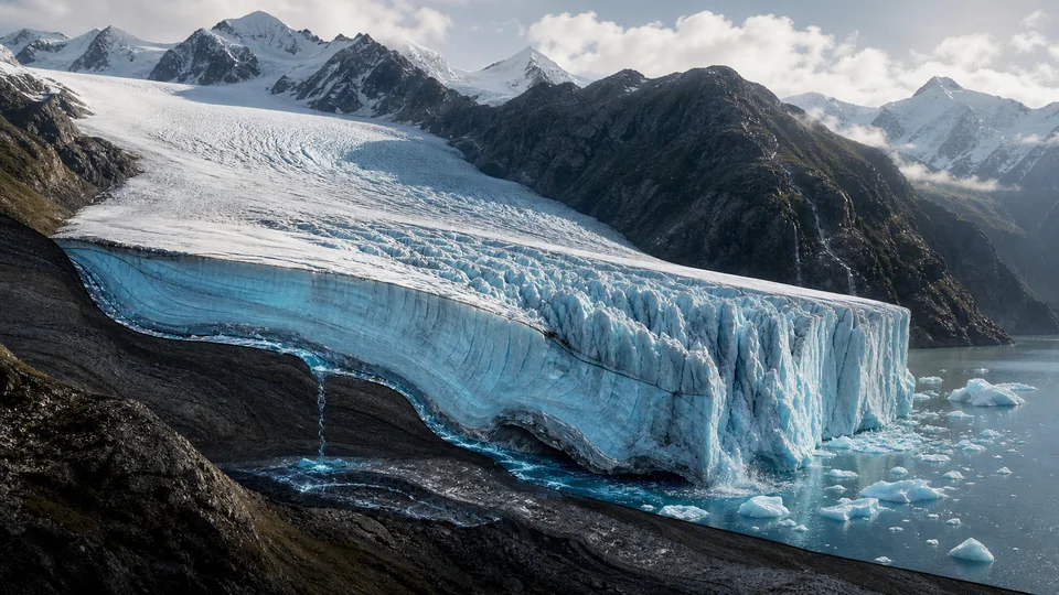
Glaciers move because gravity drives thick ice downslope. Snow accumulation adds mass, while surface melt, sublimation and calving remove it. Internal deformation, basal sliding and deformation of underlying sediment distribute motion, producing crevasses, ice streams and changing terminus positions.
Technical foundations
Ice flow is commonly represented with a nonlinear constitutive relation linking strain rate to deviatoric stress and temperature-dependent softness. Conservation of mass connects thickness change to surface accumulation, melt, ice flux and frontal loss. Full-Stokes models resolve all stress components, while shallow approximations reduce cost for continental scales under geometric assumptions. Basal motion may follow friction laws dependent on effective pressure and bed properties. Crevasse propagation and calving introduce fracture mechanics, and grounding-line migration couples marine ice to buoyancy and ocean-driven basal melt.
How it works
Stress increases with ice thickness and slope, and crystalline ice deforms nonlinearly. Meltwater reaching the bed alters water pressure and friction, sometimes speeding flow temporarily or reorganising drainage. Marine termini interact with ocean heat and buoyancy, while surface elevation feeds back on temperature and accumulation.
Measurement and research methods
Satellite radar interferometry maps surface velocity, laser and radar altimetry track elevation, and gravimetry constrains regional mass change. Airborne radar estimates ice thickness and bed topography; boreholes measure temperature, deformation and water pressure. Surface mass balance combines weather stations, snow pits and regional climate models. Data assimilation adjusts uncertain basal drag or rheology to observed velocities, but different parameter fields can fit the same surface data. Validation therefore uses withheld periods, independent thickness change and uncertainty ensembles rather than one visually plausible simulation.
Key ideas
- Glacier length is a delayed response and does not measure current mass balance directly.
- Basal hydrology can either accelerate sliding or increase drainage efficiency and reduce it.
- Ice dynamics amplify climatic forcing through geometry and contact with the ocean.
Current research frontier
Research focuses on marine ice-sheet instability, fracture-driven shelf collapse and rapid outlet-glacier response to ocean heat. Subglacial hydrology models connect distributed cavities and efficient channels to seasonal speed changes, while firn models determine how meltwater is stored or routed. Machine learning can emulate expensive simulations but must respect conservation and extrapolation limits. Major uncertainties involve bed geometry, future atmospheric and ocean forcing and processes smaller than model grids. Probabilistic sea-level projections must communicate low-likelihood high-impact outcomes alongside median estimates used for coastal adaptation.
Why it matters
Glacier dynamics determine freshwater timing, landscape evolution and a growing share of sea-level rise. Reliable projections support coastal planning and water management for communities dependent on seasonal melt.
Limits and open questions
Bed topography, ice thickness and basal properties are poorly observed beneath many glaciers. Short records limit validation of century-scale projections, and interacting atmosphere, ocean, fracture and hydrology processes remain difficult to resolve at global scale.
Explore through connected concepts
This article is indexed with 20 technical tags. Select a tag to explore the Wiki by concept.
You may also explore
Recommended from the technical tags shared with this article.
Blue Carbon Ecosystems
Coastal vegetated habitats such as mangroves, salt marshes and seagrass meadows that capture and store substantial carbon in biomass and sediments.
Read article →