Wildfire Dynamics
The coupled combustion, atmosphere, fuel and terrain processes that govern how landscape fires ignite and spread.
- Revision
- 1
- Created by
- SCIENDIA Knowledge Desk
- Updated by
- SCIENDIA Knowledge Desk
- Last updated
- 18.08.2026 11:13
Built by the community
Members can improve this article. Every saved change remains visible in the revision ledger.
Overview
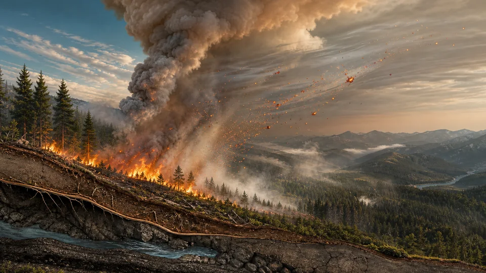
Wildfire behaviour emerges from interactions among fuel amount and continuity, vegetation moisture, wind, atmospheric stability and topography. Flames preheat unburned material through radiation and convection, while lofted embers can create new ignitions beyond the main front. Large fires can modify local winds and generate their own convective weather.
Technical foundations
Wildland combustion includes drying, pyrolysis, flaming oxidation and slower smouldering. Heat transfer ahead of the front lowers fuel moisture and releases combustible gases; oxygen supply and turbulent mixing then regulate flame intensity. Semi-empirical spread models relate forward rate to fuel load, surface-area-to-volume ratio, moisture, slope and wind. Coupled atmosphere-fire models solve fluid-flow and thermodynamic equations with heat and moisture sources from combustion, allowing the plume to accelerate winds, tilt flames and organise convection. Spot fires introduce discontinuous propagation through ember lofting, transport and probabilistic ignition.
How it works
Operational models estimate rate and direction of spread from fuel categories, slope and near-surface weather. More detailed simulators couple combustion and heat transfer with fluid dynamics, moisture loss and plume development. Satellites, aircraft, weather stations and ground crews update fire perimeters and intensity estimates as rapidly changing conditions invalidate earlier forecasts.
Measurement and research methods
Measurement integrates fuel surveys, weather stations, infrared cameras, airborne lidar and multispectral satellites. Active-fire detections provide thermal anomalies, while perimeter mapping and fire-radiative power estimate extent and energy release subject to cloud, smoke and overpass limitations. Field experiments measure flame length, consumption, heat flux and ember distributions under controlled burns. Model evaluation compares arrival times and perimeters across independent incidents and quantifies uncertainty in wind and fuel inputs. Data assimilation can update forecasts during an incident, but latency and rapidly evolving convective conditions limit how long a forecast remains actionable.
Key ideas
- Fireline behaviour can change abruptly when wind, slope and fuel align.
- Spotting allows a fire to cross barriers that stop the continuous flame front.
- Suppression decisions require uncertainty ranges rather than one deterministic perimeter.
Current research frontier
Current research examines fire-generated thunderstorms, long-range smoke exposure and compound extremes involving heat, drought and wind. High-resolution simulations seek thresholds for plume-driven transitions, while laboratory studies quantify ember ignition of structures and vegetation. Fuel treatments are evaluated as spatial networks whose effectiveness depends on maintenance and weather at encounter. Ecological models distinguish low-severity recurrent fire from stand-replacing events and include post-fire erosion and regeneration. Open challenges include representing heterogeneous live fuels, forecasting dry lightning, integrating human ignitions and communicating ensemble risk so emergency managers can act without treating uncertain boundaries as deterministic.
Why it matters
Understanding fire dynamics improves evacuation, firefighter safety, smoke forecasting and ecosystem management. It also informs prescribed burning and landscape treatments intended to reduce severe fire without eliminating ecologically necessary disturbance.
Limits and open questions
Fuel and moisture data are spatially incomplete, and extreme pyroconvection can exceed the assumptions of empirical models. Climate, land management, ignitions and settlement patterns interact, so no single intervention removes risk and model uncertainty must be communicated during emergencies.
Explore through connected concepts
This article is indexed with 20 technical tags. Select a tag to explore the Wiki by concept.
You may also explore
Recommended from the technical tags shared with this article.
Climate Feedback Loops
Processes that amplify or reduce an initial change in Earth's climate system.
Read article →